ARCGIS PRO
ESRI Cartography MOOC exercise in classifying data in different ways demonstrating how data can be manipulated.
CARTOGRAPHY
GEOGRAPHIC ANALYSIS
AERIAL IMAGERY
REMOTE SENSING
WEB MAPPING
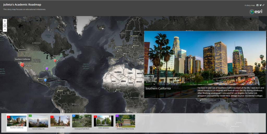
Creating a Story Map Application using ArcGIS Online
Sharing a GIS: Top 10 Hiking Spots in California
Using information from exploretheusa.com, I gathered metadata for each site: rank, name, address, state, zipcode. GoogleMaps was used to pinpoint an address, in some cases coordinates. Then I geocoded the data and implemented it ito ArcGIS Online as a map package.